- 名稱 : LIVE MAPS Guide
- 版本 : 1.0
- 系統 : 4.0.3 以上
- 官網 :
- 內容分級 : 3 歲以上
軟體介紹 :
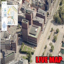 Live maps Satellite view opens up new methods of staying in touch, sharing information, locating addresses and now, it allows you to view specific addresses from satellite map live. Major Internet entities like Google or TerraServer allow you to enter an address live view satellite of earth, sometimes even down to a specific home or building. In many cases, this technology is free, requiring only a fast Internet connection.
We all love their traffic alerts, but how exactly does GoogleMaps know how clogged the highway is on your way out of town this weekend?
How Google Tracks Traffic
Features,
• How to Get Latitude From Google Maps
• How to Use Coordinates in Live Maps
• How to Find Latitudes & Longitudes for Multiple Addresses
• How to Convert Google Maps Coordinates
– How Google Tracks Traffic
One of the neat features of Google Maps is the ability to get a street view of many urban and suburban areas. The street view is an actual photograph shot with an Immersive Media camera that delivers a 360 degree image of the surroundings.
– Street View – Walk Down Your Street With Google Maps
We all love Google Earth, right? Who doesn’t like to zoom in on our home town, see our own roof, where we go to school, or where we work?
實景地圖衛星視圖打開瞭保持聯繫,共享信息,定位地址的新方法,現在,它允許您查看從衛星地圖的特定地址居住。像谷歌或TerraServer獲得主要的互聯網實體允許你進入地球的地址現場查看衛星,有時甚至下降到一個特定的傢庭或建築物。在許多情況下,這項技術是免費的,隻需要一個快速的互聯網連接。
我們都愛自己的交通警示,但究竟怎樣的GoogleMaps知道如何堵塞在高速公路上用自己的方式出城的這個週末?
谷歌如何跟蹤流量
產品特點,
•如何獲取谷歌縱橫谷歌地圖
•如何使用坐標的實景地圖
•如何查找緯度和經度為多個地址
•如何轉換谷歌地圖坐標
– 谷歌如何跟蹤流量
一個谷歌地圖的整潔的功能是得到許多城市和郊區的街景的能力。街景是一個實際的照片,身臨其境的多媒體攝像頭,提供周圍環境的360度的圖像拍攝。
– 街景 – 走你的街道,谷歌地圖
我們都愛谷歌地球,對不對?誰不喜歡放大我們的傢鄉,看到我們自己的屋頂,在那裡我們去上學,或在我們的工作?